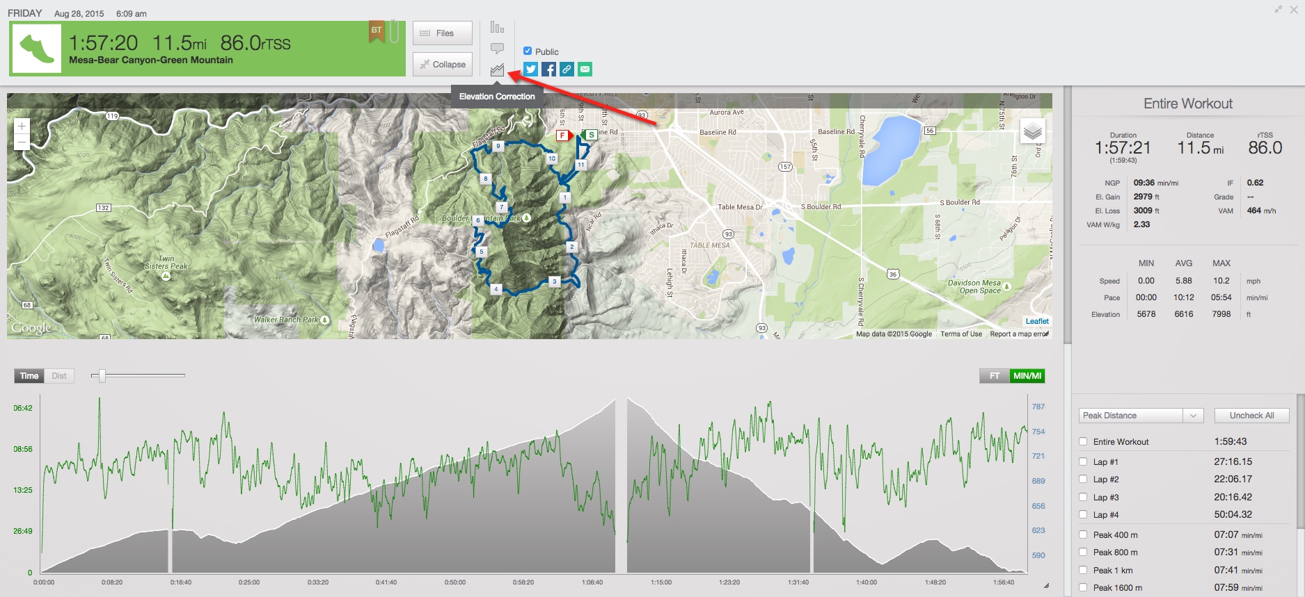
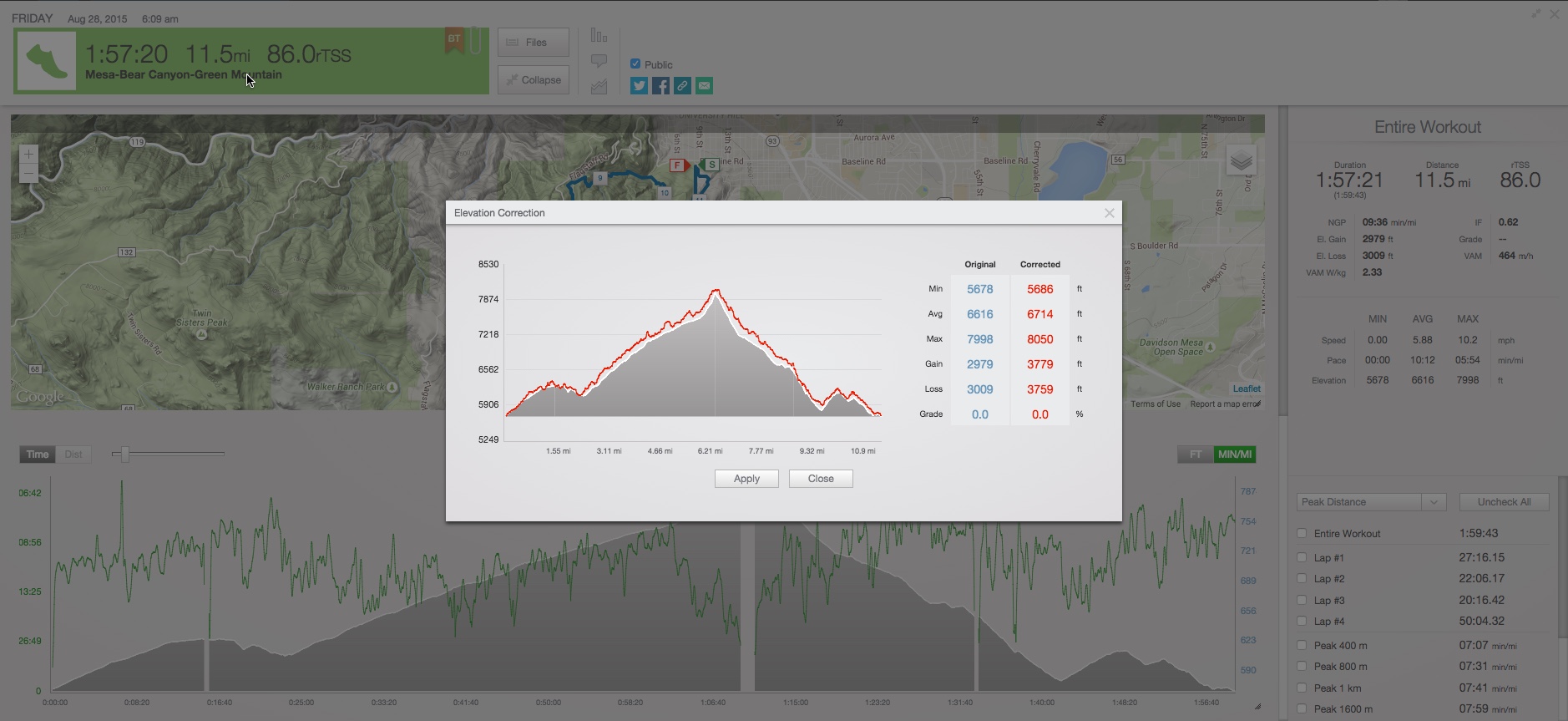
The Elevation correction feature in TrainingPeaks takes your GPS-recorded positional data and retrieves the elevation from an elevation database.
You can use elevation correction in situations where you have incorrect or incomplete elevation data such as:
- Your workout goes through a tunnel
- Your workout is in a heavily wooded area or canyon and you have an imprecise GPS lock
- Your device altimeter malfunctions
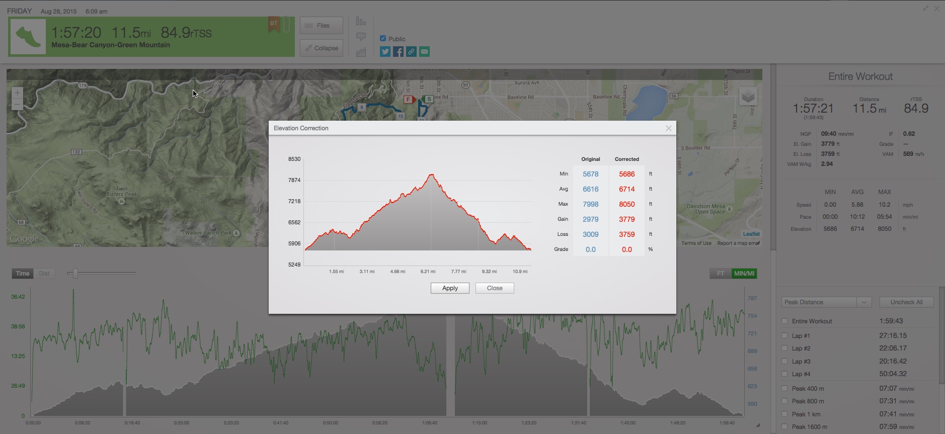
Once your file has been uploaded and you click the elevation correction button, our server will compare your positional data against the database and return a comparison for you to approve. If you feel the correction (red) is valid, click apply. If you don't like the correction you can click close.
Guidelines for using elevation correction:
- Most modern GPS devices use a barometric altimeter to record elevation. The elevation data from these devices is the most accurate and should not be corrected unless there is an obvious issue with the data or malfunction
- If you download the file attached to the quick view you will be downloaded the original file, not the corrected file. If you wish to 'undo' an elevation correction you can download this file and then re-upload it.
-
Bulk exporting from the Export Data option under Account Settings will download the original file.
-
WKO will sync the original, uncorrected file.


